Case Study
Offshore Windfarm Desk Study
Geo-4D have produced an integrated engineering geological and geohazard ground model for a proposed offshore wind farm development in the Irish Sea. An assortment of geotechnical, geophysical, and geological data was used to characterise geological and geotechnical variations across the site, and to present a set of geotechnical provinces and associated geotechnical profiles for front-end engineering design. The available data were also used to identify key natural and anthropogenic hazards and constraints to the proposed development.
Geological Model
Site-specific and publicly available data were used to document the evolution of geological processes and geological formations that have formed and shaped the present-day site, with focus on the shallow geology to 100 m below seafloor. The geological model forms the framework on which seismic interpretations, geotechnical model and hazard/constraint assessments are made.
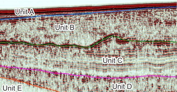
Seismostratigraphic Model
The available 2D UHR seismic and sub-bottom profiler (Innomar) data were reviewed and interpreted to define five key seismostratigraphic units, interpreted to reflect the main geological units, each with distinct geotechnical characteristics.
The seismic horizons were depth-converted and exported as gridded surfaces that could be further interrogated in ArcGIS software.
Geotechnical Model
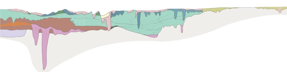
A 3D geotechnical model was developed, based on the integration of the geological model, seismostratigraphic model, and available geotechnical data. The geotechnical model was used to predict geotechnical conditions across site, identify data gaps and areas of geotechnical uncertainty, and define geotechnical parameter bounds for use in engineering analyses.
The ground model was developed in ArcGIS software, and comprised an iterative integrated approach, split over five key tasks:
- Delineate geotechnically distinct geotechnical units within the available geotechnical data;
- Calibrate the geotechnical units against the seismic units to identify geotechnically distinct seismic units and identify data gaps;
- Define geotechnical profiles to the required depth range of interest that characterise areas of similar stratigraphy;
- Map the lateral extents of the geotechnical profiles as geotechnical provinces;
- Compile and review geotechnical data and define geotechnical parameter bounds per geotechnical unit.
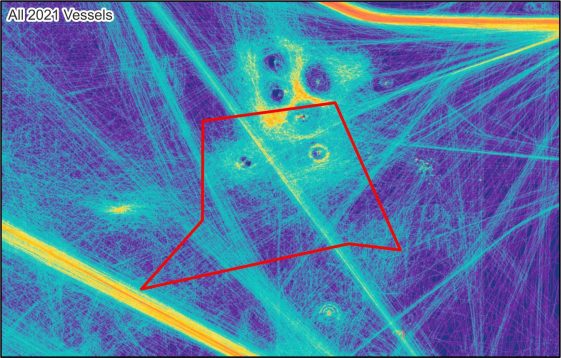
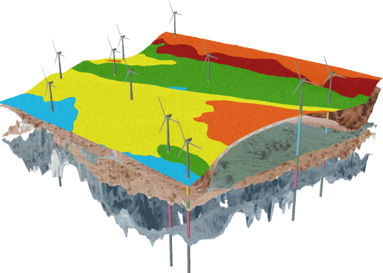
Hazard and Constraint Assessment
A high-level assessment of various natural and anthropogenic constraints (static features) and hazards (dynamic features/processes) was conducted, using available site-specific and public datasets.
Sediment mobility, shallow gas, anchor strike and trawling were highlighted as the main dynamic hazards that require further assessment prior to engineering, site investigation and development of the site.
Subsurface boulders, shallow bedrock, geotechnical variability, unexploded ordnance, existing infrastructure and wrecks were highlighted as the main static constraints hazards that may influence layout planning and site investigation.
Request a call back with us, and we will do the rest
Interested in what we do? Need more information.
Geoconsulting, remote sensing
and survey experts
Links
Receive a call back.

Get in touch with us
Navigation
Useful Information