Case Study
Landfall Characterisation
Geo-4D performed a multidisciplinary beach landfall characterisation within three days in Cornwall, UK, collecting topographical, geotechnical, magnetometry and aerial imagery data to provide input to the route selection and engineering for a major trans-Atlantic cable crossing.
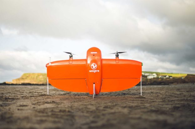
Aerial Survey
Our WingtraOne fixed-wing aircraft was flown on an autonomous mission to collect ultra-high-resolution topographical data and aerial imagery over the site. A drone-based LiDAR system was used in vegetated areas to pick up ground levels.
The imagery was used to map geological and geomorphological features, whilst the topography provided a detailed elevation profile along the cable route, and allowed for ongoing assessment of seabed level changes (i.e. erosion and deposition).
The survey was performed at spring low tide to maximise data overlap with the nearshore vessel survey.
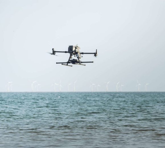
Magnetometry Survey
A magnetometer survey was conducted across the beach and shallow water area using a multirotor drone mounted with a dual-fluxgate magnetometer and a radar altimeter to maintain a constant flight altitude.
The UAV was flown at 1 m altitude at a speed of 5m/s on a 2m spaced predetermined grid, covering approximately 2 hectares per hour. Where the drone could not be flow, our G858 cesium-vapour magnetometer was used with an RTK GPS feed.
In the office all data were processed in Oasis Montaj to derive a residual total field and analytic signal from which to locate potential unexploded ordnance and existing cables, and also to demarcate geological variations, including approximation of shallow bedrock.
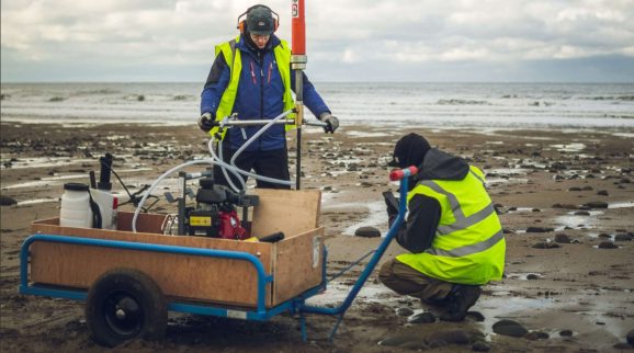
Geotechnical Probing
Our pneumatic medium-weight dynamic probe was used to probe the beach to 3 m below ground level to prove overburden thickness and derive a geotechnical stratigraphy for the beach. Data was processed to derive soil resistance profiles and a basic geotechnical zonation of the beach.

Data Integration
The available datasets were processed and reviewed against one another in ArcGIS to present an integrated characterisation of ground conditions, features and potential hazards.
Request a call back with us, and we will do the rest
Interested in what we do? Need more information.
Geoconsulting, remote sensing
and survey experts
Links
Receive a call back.

Get in touch with us
Navigation
Useful Information